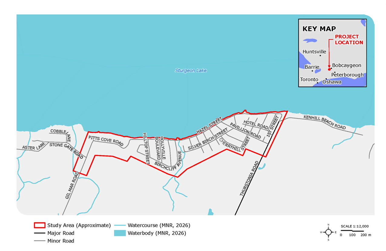
The Study Area is shown on the map below, and covers approximately 49 hectares encompassing the lands generally between: Gil Mar Road to the west; Thurstonia Road to the east; Sturgeon Lake to the North; and the lands along Pitt’s Cove Road, Birchcliffe Avenue, Silver Birch Street, and Pavillion Road to the south.
What is the project process?
This study is being completed as a master plan and will follow the requirements of Phases 1 and 2 of the Municipal Class Environmental Assessment (as amended February 2024), an approved process under the Environmental Assessment Act.
The process will include a range of background studies to document the existing conditions; engagement with Indigenous Rights Holders, agencies, and community members; development and evaluation of alternative solutions; and selection of a preferred alternative.
The recommendations and preferred alternative will be presented to City Council for consideration and next steps, which may include proceeding with detail design of the preferred alternative.
Get Involved!
Community engagement is a key component of the Drainage Study, and feedback will be used to inform decision-making throughout the study process.
Stay tuned to this project page for notices of upcoming Public Information Centres and online surveys, and subscribe to receive project updates by clicking the 'follow' button at the top of this page.
Questions or Comments
Questions or Comments
To ask a question you must create an account or log in.
These are the people that are listening and responding to your questions.
Respondent 1
{{question.description}}


